Exhibition of Ghanaian-Dutch Historic Relics and Artefacts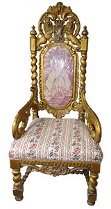
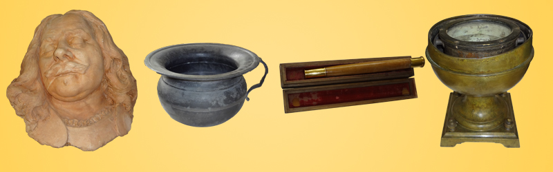
 Fort St. Anthony is host to a Museum of Ghanaian-Dutch historic relics and artefacts covering three centuries of contact and interactions between the Dutch and their Ghanaian counterparts, mainly along the coast and parts of the interior on the Ankobra River Basin. Fort St. Anthony is host to a Museum of Ghanaian-Dutch historic relics and artefacts covering three centuries of contact and interactions between the Dutch and their Ghanaian counterparts, mainly along the coast and parts of the interior on the Ankobra River Basin.
The Exhibition at the Museum features five major sections, each of which provides evidence and a vivid explanation of the three centuries of Ghanaian-Dutch contact and interactions centred on the gold trade in Axim and along the Ankobra River Basin. They are as follows:
1. Introduction to the Exhibition:
A wide selection of maps (the wider region, specific areas or towns), plans of forts and settlements; drawings, copies or transcriptions of agreements and treaties; and items from past archaeological excavations conducted around Fort St. Anthony, Dixcove, etc.
2. Trade:
Maps of trade routes and goods exchanged, drawings of ancient market places, etc., examples or pictures of goods exchanged (for instance, clothes and tobacco rolls etc.), archaeological findings connected with trade (pipes, bottles, coins, tools, etc.), examples of currencies, weights, drawings or pictures of ships, boats, canoes, rafts, porters, etc. Photographs of trading activities, traders, trade houses, etc., trade agreements, contracts, etc.
3. African-Dutch Interaction: Towns, Forts, and Communities: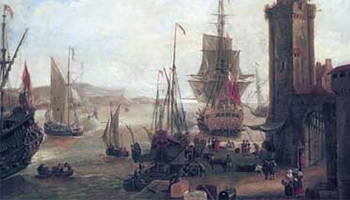
Paintings, drawings and photographs of forts, settlements, houses, shrines, churches, meeting places, harbours, military establishments, schools, missions, plantations, etc. Images of power and hierarchy: chiefs in state, retainers, town companies, Dutch commanders, officers and troops, traditional priests, church
ministers, upper class women, images of social groupings (male and female traders, Euroafricans, fishermen, farmers, slaves). Items of daily life: clothes, fashion, etc. Religious practices, festivals, bibles, cultural objects, etc.
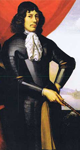
4. Some Leading Historical Characters:
Portraits, drawings, photographs, personal papers, descriptions in literature, personal items, letters, documents, possiblyregalia, weapons, flags, hats, and other objects associated with the memory of ancestors.
5. The Ankobra Gold Route:
Maps of the Ankobra region and surrounding areas from the 16th to 20th century; items from archaeological excavationsat Ankobra Hill/Elise Carthago, Essuawah/Fort Duma (near Bamianko), Dubacqua (Awudua Dada)/Fort Ruychaver; plans, maps, drawings, pictures of mines, mining concessions, mining plants, mining settlements, prospecting and mining machinery; documents concerning mining concessions; drawing and pictures of mining activities, washing for gold, Galamsey, etc.; pictures and examples of gold bullions, gold dust, artefacts in gold, etc.
|